Western Disturbance May 2026: Sudden Storms After Heatwave Relief—Why IMD Warns “Don’t Step Out Carelessly”
In our today’s blog, we’re highlighting a sudden weather change you shouldn’t ignore. After extreme April heatwaves, early May has brought relief—but with risks.
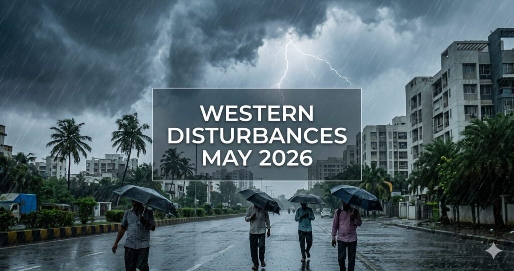
The Western Disturbance May 2026 is cooling temperatures but also triggering gusty winds, thunderstorms, and lightning, causing damage in many areas. Stay cautious before stepping out till the second week of May.
Western Disturbance May 2026: What’s Happening Right Now?
In early May 2026, an active Western Disturbance—with a fresh spell starting around May 2-3 and continued activity through May 5—is bringing significant pre-monsoon showers, dust storms, and thunderstorms across North and East India.
This Western Disturbance May 2026 is causing a sharp drop in temperatures, bringing relief from heatwaves, with heavy rain/snow likely in the Western Himalayas and gusty winds (40-60 kmph) in the plains.
Major Weather Shift: Temperature Drop & Storm Activity
Active Western Disturbances in North India are driving widespread, intense pre-monsoon activity, bringing thunderstorms, hail, and gusty winds (30-70 km/h).
These systems are causing significantly cooler, below-normal temperatures (3°C-5°C drop), acting as a major break from extreme heat. Rain-snow is expected in the Himalayas, with heavy showers in plains like Delhi-NCR, Punjab, and Rajasthan.
Key Impacts of Western Disturbance May 2026
Weather and Temperature
A “cold front” effect is causing maximum temperatures to fall by 2-5°C over Northwest and Central India.
Rain and Storms
Scattered to fairly widespread light to moderate rainfall, dust storms, and thunderstorms are expected across Punjab, Haryana, Delhi-NCR, Uttar Pradesh, and Rajasthan.
Regional Specifics
Northwest India (J&K, Himachal, Uttarakhand): Isolated heavy snowfall and rainfall
East/Central India: Thunderstorms, lightning, and gusty winds (up to 70 kmph) in Bihar, Jharkhand, Odisha, and West Bengal
South/West India: Heat remains a concern, but thunderstorms are expected in some areas
Agriculture Alert: Relief or Risk?
The Western Disturbance May 2026 is giving relief to arid regions, but it can also cause damage to unharvested crops due to strong winds and hailstorms, especially in northern areas. Farmers need to stay alert during this period.
Chardham Yatra Warning: Travel Disruptions Likely
Scattered rainfall and snowfall are expected in high-altitude areas like Kedarnath and Badrinath, with heavy rain/snow expected in isolated areas, particularly from May 5-8.
Key Concerns for Pilgrims
Heavy rain or snow can trigger landslides and road blockages
Helicopter services may be interrupted due to bad weather
Temperatures may drop suddenly, especially at night
Recommendations
Travellers should carry heavy woollens and rain gear, check weather updates, and prepare for delays.
IMD Weather Warnings (Western Disturbance May 2026)
The India Meteorological Department (IMD) has issued alerts for thunderstorms, lightning, and gusty winds (30-50 kmph), along with possible hailstorms in Uttarakhand around May 4-5, 2026.
Region-Wise Forecast Details
Northwest India
Light to moderate rainfall/snowfall with thunderstorms, lightning, and gusty winds (30-50 kmph) likely over Jammu & Kashmir, Himachal Pradesh, Punjab, Haryana, Delhi, and Rajasthan between May 5-9.
Northeast India
Scattered rainfall with thunderstorms and gusty winds (30-40 kmph) expected over Assam, Meghalaya, Nagaland, Manipur, Mizoram, and Tripura during May 5-7.
East India
Fairly widespread to widespread light to moderate rainfall with thunderstorm, lightning gusty winds (speed reaching 30-50 kmph) likely over Sub-Himalayan West Bengal & Sikkim during 05th-09th; Gangetic West Bengal during 07th-10th May.
Central India
Isolated light to moderate rainfall with thunderstorm, lightning gusty winds (speed reaching 40-50 kmph) likely over Madhya Pradesh during 06th-09th; Vidarbha on 05th and Chhattisgarh during 05th-09th May.
Next Big Weather Alert: More Intense Spell Coming
A second, potentially stronger spell of the Western Disturbance May 2026 is expected around May 10-11, bringing more rainfall and snowfall across several regions. This means the current relief phase may again turn risky.
Final Advisory: Stay Alert, Stay Safe
While the drop in temperature may feel like relief, the risks associated with storms, lightning, and strong winds should not be ignored. Avoid unnecessary travel during peak storm hours and keep track of daily weather updates.
Tell Us Your Experience
Are you also experiencing sudden winds or thunderstorms in your area due to Western Disturbance May 2026?
Drop your city name and weather condition in the comments—your update might help others stay prepared!
Disclaimer: This article is published for informational purposes only. Readers are advised to verify details from official sources before making any decisions. The website is not responsible for any loss or damage arising from the use of this information.